Rice & Irrigation Monitoring with Sentinel-1
A hands-on, reproducible tutorial over Java, Indonesia
🌐 English · Bahasa Indonesia →
This tutorial walks you, end to end, through a satellite workflow that turns Sentinel-1 radar time series — fused, for irrigation performance, with Sentinel-2/Landsat optical and rainfall/ET — into three operational products for water-resources management:
🌾 Paddy-field map
Detect rice paddies from VH backscatter phenology with an SMOTE-balanced neural network, and build a multi-year stable-paddy consensus.
📅 Planting index
Count complete flood→canopy cropping cycles per year (1×/2×/3×) to map cropping intensity — the “luas musim tanam”.
💧 Irrigation performance
Turn the maps into per-tertiary-block indices — Satisfaction (SI), Uniformity (CU), and Reliability (RI) — for a Daerah Irigasi.
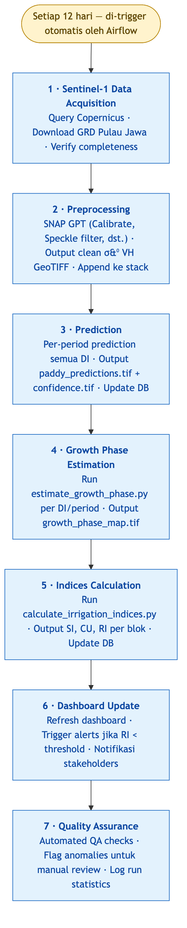
What you will build
By the end you will have reproduced, over a small sample area, the full chain:
- A VH time-series stack for an area of interest (AOI), fetched from the cloud.
- A binary paddy map and a multi-year consensus of stable paddy.
- A cropping-intensity (planting-index) map.
- A crop-coefficient (Kc) map linking phenology to water demand.
- Irrigation-performance indices (SI/CU/RI) per tertiary block for DI Klambu.
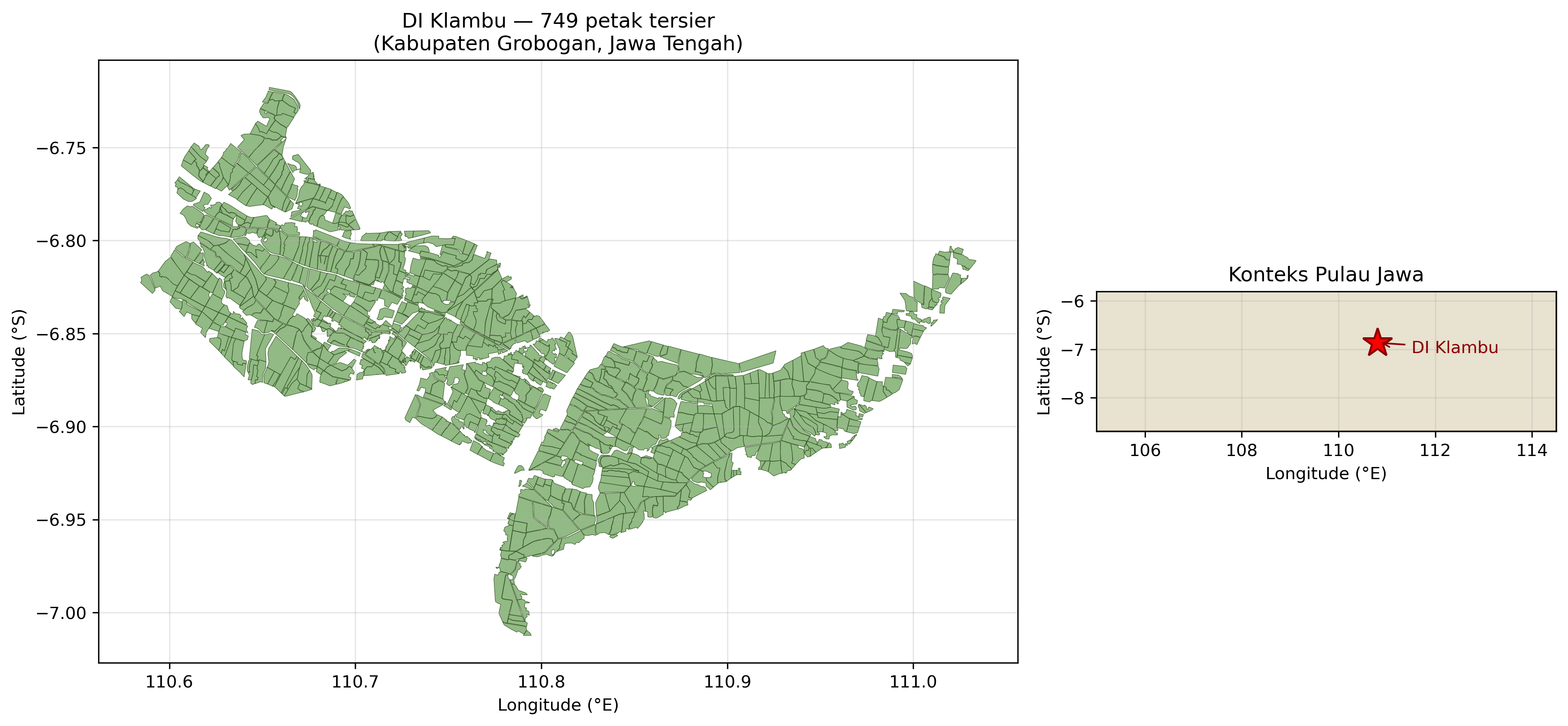
The sample area of interest
To keep everything runnable without a supercomputer, the tutorial centres on DI Klambu (Grobogan, Central Java) — the project’s flagship irrigation district (10,700 ha, 653 tertiary blocks). Its tertiary-block boundaries and reference outputs ship with the repository, and the Sentinel-1 stack for the AOI is small enough to fetch on a laptop.
How the workflow is structured
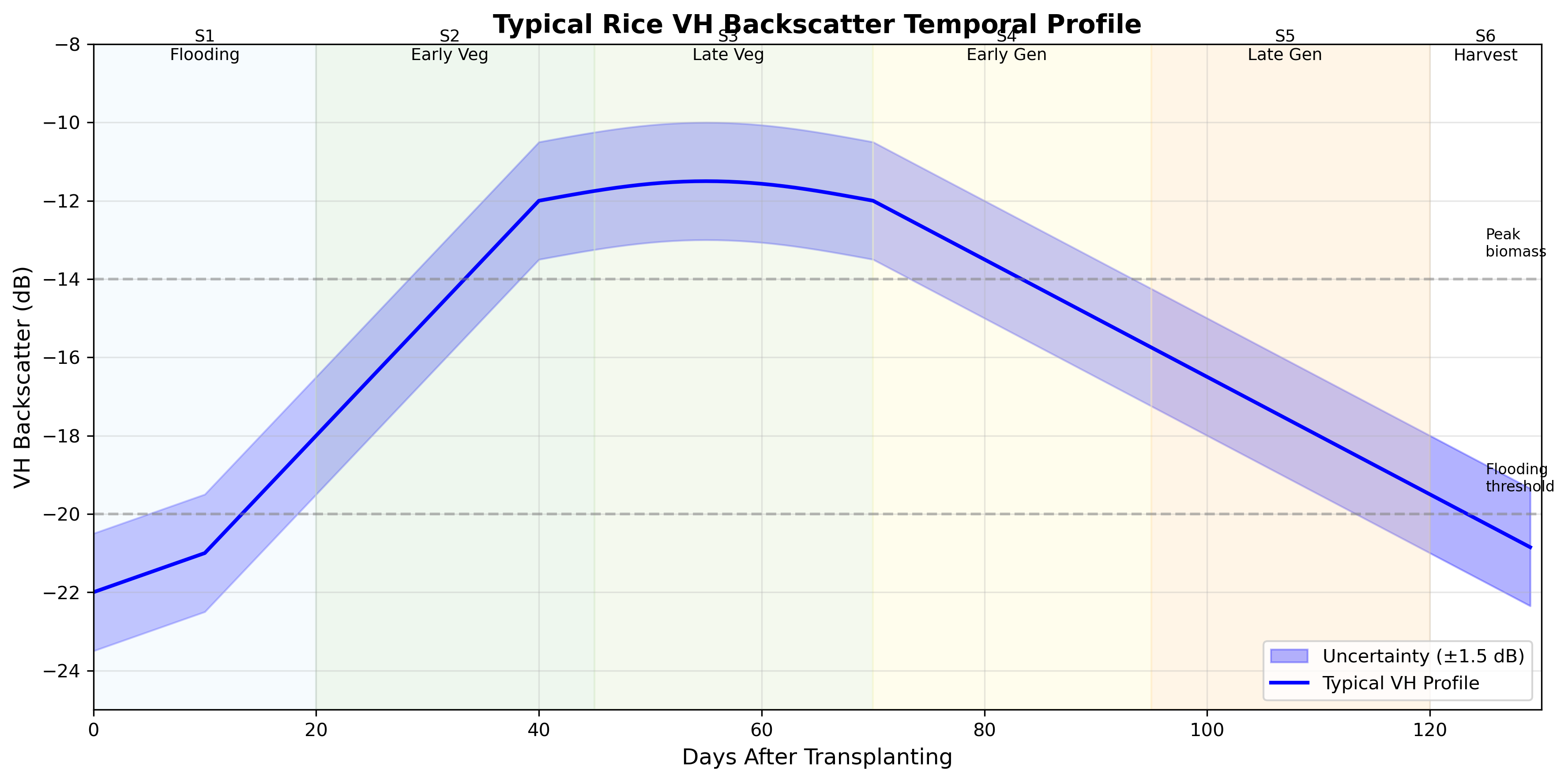
The method rests on the distinctive VH backscatter signature of rice: very low during flooding/transplanting, rising sharply through the vegetative stage to a canopy peak, then falling towards harvest. That six-stage pattern — captured every 12 days by Sentinel-1 — is what every product below is built on.
Prerequisites
- Comfortable with the Linux/macOS command line and basic Python.
- A free Google Earth Engine account (to fetch the sample Sentinel-1 stack), or your own pre-processed VH stack.
- ~4 GB RAM and a few GB of disk. No GPU required — the models run on CPU.
Start with the Setup chapter to install the environment and fetch the sample data.
This is a methods tutorial. The full Java-scale products in the reports were produced on an HPC from ~1,000 Sentinel-1 scenes; here you reproduce the same methods on a small AOI. Accuracy figures quoted are from the full study, not the toy sample.