Going further: growth-phase mapping with S1+S2 fusion
Why radar alone struggles with phenology — and how optical fusion helps
🌐 English · Bahasa Indonesia →
The limitation of VH-only phase
The cycle counter in the planting index chapter tells you how many cycles occur, but classifying the exact growth stage (flooding → vegetative → reproductive → maturity) from VH alone is hard: reproductive stages overlap in backscatter, and rainfed fields without a clear flooding trough lose the phenological anchor. On field data, a VH-only threshold phase model reached only ~32% agreement.
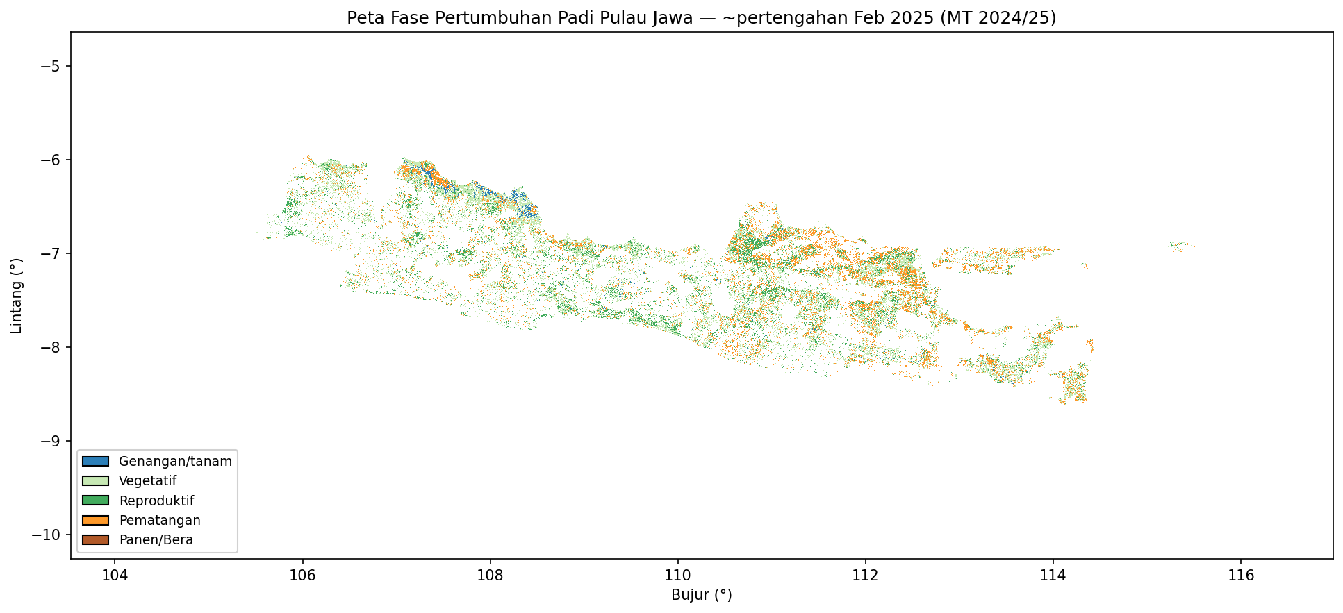
Adding optical: Sentinel-1 + Sentinel-2 fusion (MOGPR)
Sentinel-2 NDVI carries strong phenological information but is interrupted by clouds in the humid tropics. MOGPR (Multi-Output Gaussian Process Regression, from the open-source FuseTS toolkit) fuses the two: it uses the cross-correlation between VH and NDVI to fill gaps and produce a single, gap-free fused curve per pixel, which a time-series classifier (MiniROCKET + LightGBM) then labels by phase.
In the project’s evaluation (leave-one-region-out, drone-labelled points), adding optical via MOGPR raised generative-phase F1 from 0.52 (VH-only) → ~0.67 (fused) — about +15 points. Optical, it turns out, is the determinant of phenological stage; radar provides the all-weather backbone.
FuseTS/MOGPR is a free, reproducible alternative to proprietary fusion services (e.g. CropSAR) — important for a national agency on a public budget.
Where the fusion code lives
The fusion pipeline (data cubes, MOGPR, phase classifier, multi-year phase/IP/production maps) is in a separate repository:
- github.com/firmanhadi21/FuseTS — see
scripts/extract_point_series.py,scripts/train_v3_mogpr_ensemble.py, andscripts/ABLATION_HPC_RUNBOOK.md.
It requires Sentinel-2 access (Microsoft Planetary Computer) and more compute than this laptop tutorial, which is why it is presented here as an extension rather than a runnable step.
Recap
You have now seen the whole system:
- Paddy map — VH phenology + SMOTE classifier + multi-year consensus.
- Planting index — data-driven cycle counting (1×/2×/3×).
- Irrigation performance — Kc + water balance → SI/CU/RI per tertiary block.
- Growth phase — S1+S2 MOGPR fusion for accurate stage mapping (extension).
Together they turn free radar imagery into decision-ready information for irrigation management. Thank you for following along — issues and contributions are welcome on GitHub.